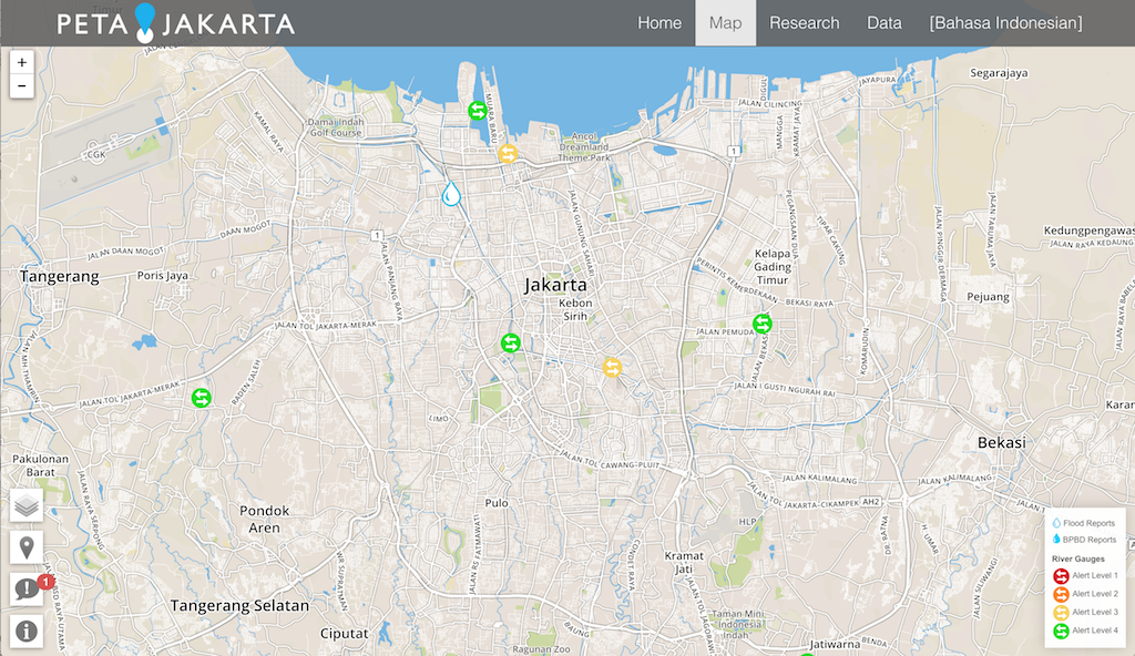
PetaJakarta (Indonesian for “MapJakarta”) is a web site that provides near real time mapping of social media flood reports and government sourced data relating to floods in Jakarta, Indonesia.The PetaJakarta.org project, launched version 1 in May 2014, as a collaborative initiative between Badan Penanggulangan Bencana Daerah (BPBD) DKI Jakarta with SMART Infrastructure Facility University of Wollongong, and Twitter.
PetaJakarta.org is supported by the University of Wollongong Global Challenges Program, DMInnovation, and the Department of Foreign Affairs and Trade of the Government of Australia. The Australian National Data Service supports the development and maintenance of the open data and open source software.
Ubiquitous access to current hazard data is a key enabler for disaster managers working to ensure the safety and well being of citizens and infrastructure during natural disasters. As such PetaJakarta is a great resource since it offers an up-to-the-minute view of what is going on in the ground.
“This free and open source platform that we called geo-social intelligence engineering, will turn geo-tagged Tweets into valuable data that can be used by Indonesian citizens and government agencies to identify, navigate, and respond more quickly to seasonal flooding across Jakarta with unprecedented detail,” – Dr. Tomas Holderness, Project Co-Directors.
There are two main streams of information that are useful to InaSAFE users:
- Point reports from Twitter, Qlue (a google citizen reporting platform) and Ditik (crowd sourced news reports from Indonesia)
- Polygon records from BPBD DKI (the local government disaster management agency for Jakarta)
The point reports are realtime notifications from citizens observing flooding in Jakarta. These are used as part of the decision making process to determine if a particular area is flooded in Jakarta. Once an official determination has been made, polygons designated as ‘flooded’ are published as an overlay on the city map.
Relevance to InaSAFE
As a tool for Disaster Managers, InaSAFE’s goal is to promote better planning and preparedness for natural disasters like urban flooding. Naturally a key requirement in such an activity is having hazard data that can be used to understand which areas are impacted and to what severity level. In InaSAFE we are building a tool that will allow you to seamlessly fetch flood polygon data from PetaJakarta for use in InaSAFE. We are also building a new near-realtime interface (not available yet) for realtime.inasafe.org that will automatically generate an InaSAFE flood impact report and maintain an archive of historical flood data retrieved from PetaJakarta. We will post more news about that when it is available online.
Conclusion
Being prepared for and responding to natural disasters is not something one project can do in isolation. It takes collaboration across a wide range of disciplines: making data available, building software, understanding workflows of disaster managers and getting input from scientists and domain experts so that we can apply the best science and best practices to our field. PetaJakarta is a brilliant example of how novel approaches to data gathering can make a real impact on the ability of Disaster Managers to be better prepared for disasters.
